Stormwater Quality
Stormwater runoff is the water that flows over the ground as the result of rain, snowmelt, hail and sleet. Buildings, streets, driveways, parking lots, sidewalks and patios prevent the water from soaking into the ground. These structures are referred to as impervious surfaces. Runoff is collected by storm sewer infrastructure such as inlets and pipes and is then transported to multiple drainage basins throughout Thornton including, Big Dry Creek, Brantner Gulch, Todd Creek, Grange Hall Creek, Niver Creek, and their tributaries; all of which ultimately flow to the South Platte River. As water flows over the ground, it picks up everything in its path, such as sediment, oil, grease, litter and chemicals, taking it all to the basins without treatment.
New Stormwater Code Ordinance and Permitting Process Starting January 1, 2026
Review the Stormwater Code updates. [PDF/173KB]
Editor's note— The following is Chapter 22 Articles V. Grading, Stormwater, Erosion and Sediment Control and VI. Floodplain Regulations of the Thornton City Code as amended by Ordinance 3737 adopted by City Council on second and final reading on August 13, 2025 and effective September 1, 2025.
Chapter 22 – ENVIRONMENT
Article V. - Grading, Stormwater, Erosion and Sediment Control
DIVISION 1. – GENERALLY
Sec. 22-111. - Purpose.
This article is enacted for the purpose of regulating land disturbance activity on property within the incorporated area of the city to safeguard life, limb, health, property, and public welfare; to avoid pollution of watercourses with nutrients, sediments, and other earthen materials generated on or caused by surface runoff on or across the permitted area; and to ensure that the intended use of the graded site is consistent with the city subdivision and zoning codes, and related approvals.
Sec. 22-112. - Definitions.
The following words, terms and phrases, when used in this article, shall have the meanings ascribed to them in this section, except where the context clearly indicates a different meaning. Terms not defined herein shall have the meanings ascribed to them in any other Chapter of this city code and the director is authorized to interpret any undefined term in accordance with definitions used in professionally accepted sources.
Applicant means any person filing for an application pursuant to this article.
Best management practices (BMPs) shall have the same meaning as stormwater control measures (SCMs), and are schedules of activities, facilities, designs, prohibitions of practices, maintenance procedures, and other management practices used to prevent or reduce non-storm water pollution of the municipal separate storm sewer, Waters of the State and Waters of the United States. BMPs also include operating procedures, treatment requirements, and other practices to control plant site runoff, spillage of leaks, sludge or waste disposal, and drainage from raw material storage.
Board means the board of adjustment of the city.
CDPHE means the Colorado Department of Public Health and Environment.
CDPS means the Colorado Discharge Permit System.
Clearing means any activity that removes, whether purposefully or incidentally, the vegetative surface cover of an area.
Clean Water Act (CWA) means the Federal Water Pollution Control Act (33 USC section 1251 et seq.), and any subsequent amendments.
City inspector means a City employee(s) authorized to inspect a site with the purpose of determining compliance with the provisions of this Chapter.
City manager means the City Manager of the Thornton or the City Manager's designee.
Construction activities means construction activities as defined as “Applicable Construction Activity” in the Colorado Discharge Permit System General Permit COR090000 Stormwater Discharges Associated With Municipal Separate Storm Sewer Systems (MS4s) as from time to time amended.
Cut see "excavation."
Department means the city development and / or infrastructure department of the city, as may be appropriate.
Development engineering manager means the development engineering division head or designee.
Director means the city development director or executive director of utilities and infrastructure, or the Directors’ respective designees.
Drainage report means a comprehensive analysis of the drainage, flood control, and erosion control constraints on and impacts resulting from a proposed platting, development, or construction project. This report should also show the disposition of all runoff from the property, whether current or projected.
Drainage study means the determination of predevelopment and post development stormwater runoff based on specific recurrence intervals including the one percent chance (one hundred year) storm utilizing the basin’s hydrology and hydraulics. A drainage study may also identify necessary construction for conveying future flows and/or establishing or preserving a stable channel.
Embankment see "fill."
Erosion means the wearing away and transportation of earth material as a result of the movement of wind, water, or ice.
Erosion control means a practice or measure that prevents or reduces the migration of soil and sediment caused by wind or water.
Erosion and sediment control drawings means an illustrative plan set that shows the location and extent of all erosion and sediment control measures, as well as other associated information required by the MS4 Permit and the City Standards and Specifications.
Excavation or cut means the removal or relocation of earth materials by mechanical means, and includes the conditions resulting therefrom.
FEMA means the Federal Emergency Management Agency.
FHAD means a Flood Hazard Area Delineation adopted by the city.
Fill means a deposit of earth material placed by artificial means.
Final stabilization means all ground surface disturbing activities at the site have been completed, and uniform vegetative coverage of at least 70 percent pre-disturbance plant density has been established, or equivalent permanent, physical erosion reduction methods have been installed.
FIRM means the Flood Insurance Rate Map.
Grade means the vertical location or slope of the ground surface.
Existing grade means the ground surface prior to any earth disturbing activities.
Finish grade means the final ground surface of the site following installation of all proposed landscaping and stabilization of all disturbed soils.
Rough grade means the stage at which the ground surface approximately conforms to the grading plan, prior to landscaping and Final Stabilization. This could also mean an interim grading step per an approved phased construction plan.
Grading means the act of excavating, filling, or a combination thereof, and which changes the existing topography.
Grading permit means a permit to excavate or fill, or combination of both, which changes the existing topography of the land. Such permit includes but is not limited to a construction permit that allows only for grading. Any such permit shall address erosion and sediment control activities.
Grading plan means a set of plans showing proposed land surface changes to a given area.
Illicit connections mean any illegal and/or improper connections to storm drainage systems and receiving waters.
Illicit discharge means any discharge to the municipal separate storm sewer system that is not composed entirely of stormwater, except for discharges allowed under a NPDES permit or waters used for firefighting operations.
Impervious surface means surfaces or covers on or in real property that prevents or significantly impedes absorption and infiltration of stormwater into the earth. This includes but is not limited to buildings, manmade structures, driveways, patio areas, roofs, concrete or asphalt sidewalks, parking lots, or storage areas.
Land disturbance activity or earth disturbance means any manmade change to landform, vegetation and hydrology, creates bare soil, or otherwise may cause erosion or sedimentation, that potentially changes its runoff characteristics. This includes but is not limited to any clearing, grading, excavation, placement of fill materials, paving, construction, or anything that causes substantial removal of vegetation.
Larger common plan of development means any contiguous area where multiple separate and distinct construction activities may be taking place at different times on different schedules, but remain related. Wherein “contiguous” means construction activities located in close proximity to each other (within ¼ mile). Construction activities are considered to be “related” if they share the same development plan, builder or contractor, equipment, storage areas, etc. “Common plan of development or sale” includes construction activities that are associated with the construction of field wide oil and gas permits for facilities that are related.
Limits of construction means the perimeter area shown on erosion control plans where construction activities can take place.
MHFD means the Urban Drainage and Flood Control District now doing business as the Mile High Flood District.
Municipal separate storm sewer system (MS4) means the city's storm sewer system. The system of conveyances including municipal roads with drainage systems, catch basins, culverts, curbs, gutters, ditches, man-made channels, detention and retention facilities, all for conveying storm water.
National pollutant discharge elimination system (NPDES) Permit means any general, group and individual stormwater discharge permits which regulate facilities defined in Federal NPDES regulations pursuant to the Clean Water Act. NPDES permits are issued by the State of Colorado as Colorado discharge permitting system (CDPS) permits.
Notice of violation (NOV) means a written notice provided by a city inspector if there are site-wide, systemic, and/or repeated non-compliance issues that have not been resolved. The issuance of an NOV may be associated with a re-inspection fee.
Owner means the recorded owner of the real property and the owner's lessee, if applicable.
Permittee means the owner and owner's authorized agent who has obtained a Stormwater quality permit from the City.
Permanent stormwater control measures means constructed facilities or technology designed to reduce stormwater runoff volume, peak flow, and pollutants before discharging into receiving waters or the city’s MS4.
Person means any individual, corporation, partnership, association, State, municipality, commission, or political subdivision of a State, or any interstate body.
Pollutant means any substance that is harmful to humans, animals, public health, the environment, or that can degrade the quality of receiving waters, cause the receiving waters to violate the stream standards established by the State of Colorado, or affect beneficial uses of water. The term includes, but is not limited to, sediment, dredged spoil, rock, sand, silt, incinerator residue, ash; solid waste; sewage; wastes from industrial, commercial, domestic, or agricultural sources; trash, litter, garbage or food waste; landscaping materials, lawn clippings, leaves, branches or other landscaping and yard debris; medical waste; wrecked or discarded equipment; radioactive materials; wastes that contain bacteria, viruses and other pathogens that pose a threat to human health; pet wastes; heat, surfactants, soaps, and cleaning products and wastes and residues from washing operations, including those that are biodegradable; oil and grease, petroleum hydrocarbons and antifreeze; metals; and toxic or hazardous wastes as defined by federal, state, or local laws and regulations, including biocides and pesticides.
Professional engineer means any person licensed by the state of Colorado to practice in the discipline of civil engineering.
Professional land surveyor means any person licensed by the state of Colorado to practice in the discipline of land surveying.
Receiving waters means any surface waters of the state or surface waters of the United States into which stormwater associated with construction activities discharges. Examples include all water courses, even if they are usually dry, such as borrow ditches, arroyos, and other unnamed waterways.
Sediment means any material transported or deposited by water, including soil, debris, or other foreign matter.
Sediment control means a practice or device designed to keep soil on a construction site from migrating into a storm system, watercourse, or any area outside of the limits of construction.
Site means any lot or parcel of land or combination of contiguous lots or parcels of land, whether held separately or joined together in common ownership or occupancy, where grading is to be performed or has been performed.
Slope means a surface inclination of which may be expressed as the ratio or percentage of horizontal distance to vertical distance.
Soil means an all earth material of any origin that overlies bedrock and may include the decomposed zone of bedrock which can be excavated readily by mechanical means.
Standards and specifications means the current version of the City of Thornton Standards and Specifications for the Design and Construction of Public and Private Improvements.
Stop work order means a city-issued order requiring all construction activities to cease until further notice.
Storm sewer system means facilities by which storm water is collected and/or conveyed, including but not limited to any roads with drainage systems, municipal streets, gutters, curbs, inlets, piped storm drains, pumping facilities, retention and detention basins, natural and human-made or altered drainage channels, reservoirs, and other drainage structures.
Stormwater means runoff generated from rain and snowmelt that flows over land or impervious surfaces, such as paved streets, parking lots, and building rooftops, and does not soak into the ground.
Stormwater control measures (SMCs)see “best management practices.”
Stormwater coordinator means the manager of the city’s MS4 permit, or the stormwater coordinator’s designee. The stormwater coordinator administers, develops, coordinates, documents, and enforces the City’s stormwater management program in accordance with the CDPS General Permit for stormwater discharges associated with MS4s.
Stormwater quality permit means a permit issued by the city that specifically authorizes the entity listed to discharge as of the effective dates stated on the certification, in accordance with BMPs or SCMs for prevention or reduction of stormwater pollution. It is required if one acre or more of Land Disturbance activity will occur, or for less than one-acre if part of a larger common plan of development.
Stormwater quality means the physical, chemical, and biological characteristics of stormwater in respect to its suitability for a particular purpose.
Stormwater management plan (SWMP) means a document which describes SCMs and activities to be implemented by a person or permittee to identify sources of pollution or contamination at a site and the actions to eliminate or reduce pollutant discharges to stormwater, stormwater conveyance systems, or receiving waters to the maximum extent practicable.
Structural control measure means a stationary and permanent BMP that is designed, constructed, and operated to prevent or reduce the discharge of pollutants in stormwater.
UDFCD means the Urban Drainage and Flood Control District now doing business as Mile High Flood District (see MHFD).
Vegetative cover means grasses, shrubs, trees, bushes, and other plants.
Watercourse means any natural or manmade channel, ditch, conveyance, drainageway, or the standing body of water into which stormwater is discharged.
Waters of the State (WOTS) any and all surface and subsurface waters which are contained in or flow in or through this state, but not including waters in sewage systems, waters in treatment works of disposal systems, waters in potable water distribution systems, and all water withdrawn for use until use and treatment have been completed. This definition can include water courses that are usually dry.
Waters of the United States (WOTUS) means surface watercourses and water bodies as defined under 40 CFR § 122.2 as amended including all natural waterways and definite channels and depressions in the earth that may carry water, even though such waterways may only carry storm water during precipitation and may not carry storm water at and/or during all times and seasons.
Sec. 22-113. - Grading permit required.
Except for specific exemptions listed hereinafter, no person shall do or permit to be done on any site in the city any grading or other surface disturbance such that quantities of dirt, soil, rock, debris, or other material substantially in excess of natural levels are washed, eroded, or otherwise moved from the site except as specifically provided for by a valid grading permit issued by the development engineering manager.
Sec. 22-114. - Exemptions.
The following grading may be done without obtaining a grading permit. Exemption from the requirement of a permit shall not be deemed to be permission to violate any provision of this article.
(1) Minor projects which have cuts or fills, each of which is less than five feet in vertical depth at its deepest point measured from the existing ground surface, and which include all of the following:
a. Less than 50 bank cubic yards of material.
b. Do not create unstable or erodible slopes or fields; including grading which does not remove topsoil and vegetation.
c. Do not encroach into a drainageway or watercourse.
(2) Excavations in connection with a swimming pool authorized by a valid building permit.
(3) Trenching and grading incidental to the construction or installation of approved underground pipelines, septic tanks and sewage disposal fields, conduits, electrical or communication facilities, and drilling or excavation for post holes or approved wells.
(4) Excavations of less than 100 and 150 cubic yards for soil or geologic investigations by a professional engineer.
(5) Grading in accordance with plans incorporated in an approved surface mining permit.
(6) Routine cemetery excavations and fills.
(7) An excavation below finished grade for basements and footings of a building authorized by a valid building permit.
(8) Grading work performed by the city.
(9) Agricultural and farming activities including tilling, plowing, and excavation for irrigation ditches.
Sec. 22-115. - Stormwater quality permit required.
A stormwater quality permit will be required for any land disturbance activity of more than one acre of surface area. Additionally, land disturbance activity may be permitted to be phased so that no more than forty (40) acres surface area within a development is disturbed at any given time. Variances allowing for more than forty (40) acres of disturbance at one time may be authorized by the director. Applications for a stormwater quality permit shall not be processed unless the fee therefore has been paid. Stormwater quality permit and reinspection fees shall be established by resolution adopted by the city council. Stormwater fees, if concurrent with other construction or building permit fees shall be collected by city development but shall be deposited or transferred to the stormwater enterprise fund. Stormwater quality permits shall be valid for up to two years from the date of issuance. Upon expiration of the permit, if construction and revegetation requirements are not complete, permit holder shall apply for a renewal of the stormwater quality permit and pay the associated renewal fee.
Sec. 22-116. - Water obstruction.
No person shall do or permit to be done any grading which may obstruct, impede or interfere with the natural flow of storm waters, whether such waters are unconfined upon the surface of the land or confined within land depressions or natural drainageways, unimproved channels or watercourses, or improved ditches, channels, streets, or conduits in such a manner as to cause flooding where it would not otherwise occur, aggravate any existing flooding condition or cause accelerated erosion except where grading is in accordance with all applicable federal, state, and local laws, including but not limited to this article.
Sec. 22-117. - Hazards.
Whenever the development engineering manager or stormwater coordinator determines that any grading on private property constitutes a condition which is a hazard to public safety, endangers property, adversely affects the safety, use or stability of adjacent property, or an overhead or underground utility, or a public way, watercourse, or drainage channel, or could adversely affect the water quality of any water bodies or watercourses, the owner of the property upon which the condition is located, or other person or agent in control of said property, upon receipt of notice in writing from the development engineering manager shall, within the period specified therein, obtain a grading or stormwater quality permit and conform to the conditions of said permit. The development engineering manager or stormwater coordinator may require the submission of plans or soil or geological reports, detailed construction recommendations, drainage study or other engineering data prior to and in connection with any corrective or proposed work or activity.
Sec. 22-118. - Technical excavation, grading and other standards.
All clearing, construction activities, excavation, fill, grading, land disturbance activity or earth disturbance activity must be completed in accordance with the requirements of this code and in accordance with city standards and specifications and associated checklists provided by the city.
Secs. 22-119—22-130. - Reserved.
DIVISION 2. - PROCEDURES
Sec. 22-131. - Filing.
Applications for grading and stormwater quality permits shall be filed with the city on forms furnished by the city. Each application shall include a preliminary and/or final grading plan and a preliminary and/or final erosion and sediment control plan. The city shall determine if the application is complete in accordance with the provisions of this article. The applicant shall be notified if the application is deemed incomplete and the requirements for completing the application.
Sec. 22-132. - Permit conditions.
(a) No permit shall be granted unless the project conforms to the city subdivision and zoning codes, all applicable city ordinances and the city’s adopted standards and specifications. No land disturbance activity may exceed forty (40) acres on any one site unless a variance is authorized by the director.
(b) The permit shall be limited to work shown on the grading plans, and the erosion and sediment control plans, as approved by the city. In granting a permit, the city may impose any condition deemed necessary to protect the health, safety and welfare of the public, to prevent the creation of a hazard to public or private property, and to assure proper completion of the grading, including, but not limited to:
(1) Mitigation of any adverse environmental impacts.
(2) Requirements for dust, erosion, replacement of vegetation, sediment and noise control, hours of operation, sequence of work, access roads and haul routes, and work area traffic control.
(3) Requirements for safeguarding watercourses, whether natural or manmade, from pollutants and excess deposition of sediment or debris in quantities exceeding normal levels.
(4) Temporary control measures downgradient prior to disturbance, to be removed after stabilization.
(5) Requirements for submitting a tree mitigation plan in accordance with the provisions of the City Development Code, Chapter 18.
(6) Keeping public street and rights-of-ways free from mud and debris. For purposes of this Article V, the definition of debris includes discarded construction material of any type.
Sec. 22-133. - Permission of other agencies or owners.
No permit shall relieve the permittee of the responsibility for securing any other permits or approvals required for work which is regulated by any other department of the city, the county, the state, or any other public agency, or for obtaining any easements or authorization on property not owned by the permittee. Proof of application for applicable public agency permits may be required prior to issuance of a permit.
Sec. 22-134. - Time limits.
- The permittee shall perform and complete all the work required by the permit including regular clean up of mud and debris within the time limits specified in the permit. If the work cannot be completed within the specified time, a request for an extension of time setting forth the reasons for the requested extension shall be presented in writing to the Permit issuer no later than five days prior to the expiration of the permit. The Permit issuer may grant additional time for the work.
With regard to stormwater quality permits, if construction and revegetation requirements have not been met two years following the date of stormwater quality permit issuance, permit holder shall apply for renewal of the stormwater quality permit and pay the associated stormwater quality permit renewal fee.
(c) If the work is not completed within the time limit specified in subsection (a) above, the city may utilize funds deposited in escrow pursuant to any development agreement, seed or revegetation guarantee or surety that was required by the city as relates to the permitted project, for the completion of the work and/or restoration of the site.
Sec. 22-135. - Validity.
The issuance of a permit or approval of plans and specifications shall not be construed as an approval or waiver of any violation of the provisions of this article or any other applicable laws, ordinances, rules or regulations.
Secs. 22-136—22-140. - Reserved.
DIVISION 3. - PLANS AND SPECIFICATIONS
Sec. 22-141. - Application.
Grading and erosion and sediment control plans shall be prepared in accordance with city standards and specifications and associated checklists provided by the city.
Sec. 22-142. - Approved plans—Modification.
(a) Proposed modification to an approved grading or erosion and sediment control plan shall be submitted to the city for approval.
(b) All necessary soils and geotechnical information and design details shall accompany any request for modification.
(c) The modification shall be compatible with any approved subdivision plat and all land use requirements as applicable.
Secs. 22-143—22-150. - Reserved.
DIVISION 4. - PERMIT REQUIREMENTS
Sec. 22-151. - General.
The city will issue a grading permit if final plans satisfy the provisions of this article and all of the conditions imposed. The permit issuer shall identify the provision, requirement or condition that has not been met or performed by the applicant in the event the issuance of a permit is denied.
Sec. 22-152. - Fees.
(a) The schedule of fees and costs shall be those established and adopted from time to time by resolution of the city council. Before a permit is issued, the applicant shall deposit with city development, in a form acceptable to the city and in a sufficient sum to cover the fee for issuance of a permit, charges for review of plans, investigations and inspections, in accordance with schedules adopted by the city council.
(b) If, upon completion of the work there remains any excess of deposit required by 22-152(a), the development engineering manager shall certify the same to the executive director of finance of the city for refund to the permittee.
(c) If grading work is done in violation of this article or such work is not in accordance with the approved permit, a fee, not less than twice the normal fee, covering investigation of any violation and inspection and plan checking of work required to correct such violation shall be charged to such violator to cover all costs. No additional permits will be reviewed or considered for that permittee until said costs are paid.
Sec. 22-153. - Geotechnical investigation required.
The application for a permit shall include a geotechnical report, prepared by a professional engineer, which includes and meets all requirements of the city standards and specifications and associated checklists provided by the city.
Sec. 22-154. - Construction materials testing reports.
Upon completion of the permitted work, a construction materials testing report prepared by a professional engineer shall be submitted to the development engineering manager for approval. The report shall include, information as detailed in the city standards and specifications and associated checklists provided by the city.
Sec. 22-155. - As-built plans.
The permittee shall submit to the permit issuer an "as-built" plan following completion of the grading operation. The "as-built" plan shall be completed in accordance with the city standards and specifications and signed and sealed by a professional engineer and a professional land surveyor.
Sec. 22-156. - Responsibilities of permittee.
The permittee under a grading permit, stormwater quality permit, or floodplain permit, shall also be responsible for the following:
(1) Protection of utilities. The permittee shall be responsible for the prevention of damage to any public utility or service.
(2) Protection of adjacent property. The permittee is responsible for the prevention of damage to adjacent property. Excavation shall not occur sufficiently close to the property line to endanger any adjoining public street, sidewalk, utilities, or other public or private property, or easement, without protecting such property from damage which might result.
(3) Protection of public streets. The permittee is responsible for the regular removal of any mud or debris that is tracked in the public right-of-way resulting from vehicles and equipment entering and leaving the site. Regular removal shall mean by the end of every workday that the permittee is working at the construction site, before the permittee leaves the construction site. Failure to remove such mud or debris in accordance with the notice as provided in subsection (6) herein, shall be deemed to create a public nuisance which may be abated in accordance with Section 38-391, in addition to any other remedies provided by the Thornton City Code.
(4) Protection of trees. The permittee shall be responsible for the protection of all trees designated on the approved grading plan or other city approved development activity document to remain, unless an alternative plan allowing tree removal, relocation or other revegetation requirements has been approved by the city.
(5) Erosion, sediment, and dust control. The permittee shall be responsible to prevent discharge of sediment or dust from the site to any watercourse, drainage system, or adjacent property by implementing temporary and permanent BMPs and to protect from all damage that may result from wind, erosion, or sedimentation from the site. The permittee shall be responsible for maintenance of all temporary structural BMPs used to prevent discharge of sediment or dust from the site until final stabilization of all disturbed areas. Permittee shall promptly remove any temporary BMPs after final stabilization.
(6) Remedies. If any of the above items are not being carried out in a manner satisfactory to the city or in accordance with this section, the city shall provide notice to the permittee to correct the condition without delay. If the permittee does not adequately remedy the condition, the city may use the security deposit to remedy the condition and the permittee will have no claim or right to any of the funds spent for on-site or off-site mitigation efforts or to correct property damage, or the city may order all work stopped by order of the development engineering manager in accordance with Division 7 enforcement of this Article.
(7) Advance notification. The permittee shall notify the development engineering manager at least 24 hours prior to the start of work.
(8) Transfer of permit. No permit issued under this article may be transferred or assigned in any manner without the approval of the development engineering manager.
(9) Compliance with State and Federal Requirements. Any grading, stormwater quality, floodplain, construction or building permit issued by the city is contingent upon conformance with State Regulation 61. When a CDPS-stormwater discharge permit is issued by the state, a copy shall be provided to the city.
Secs. 22-157—22-180. - Reserved.
DIVISION 5. - Stormwater Runoff Control Requirements
Sec. 22-181. - Adoption of Storm Drainage Master Plans and Drainage Criteria Manuals.
(a) All master plans, reports, studies, and manuals regarding stormwater drainage and/or stormwater quality on file with the floodplain administrator prepared on behalf of the city are adopted by reference and incorporated in this Code. All stormwater quantity and stormwater quality facilities constructed in the city shall comply with the Standards and Specifications for the city and all documents adopted by reference. The floodplain administrator has the authority to permit variances to any adopted drainage Standards and Specifications provided in this division, when in the best interests of the city, and such variance shall be in accordance with sound engineering practices.
(b) The MHFD Urban Storm Drainage Criteria Manual, as amended, is accepted and adopted by reference and declared to be a part of this division.
(c) In areas where there is a conflict between the criteria manuals, city stormwater program manuals, and Standards and Specifications, the more restrictive requirement shall govern.
Sec. 22-182. - Permanent Stormwater Control Measures and Drainage Design.
- Design of permanent stormwater control measures, including but not limited to best management practices for permanent water quality, shall be based upon the MHFD Urban Storm Drainage Criteria Manual and the city’s MS4 permit requirements, as may be amended from time to time.
- Unless otherwise permitted by the director, designs must maintain historic flow patterns in such a manner that will prevent property damage of the type usually attributed to runoff rates and velocity increase, diversions, concentration and/or the unplanned ponding of storm runoff. All new development, expansion, or redevelopment shall mitigate runoff pursuant to this article.
- The minimum detention volume and maximum release rates shall be calculated based on the Standards and Specifications. Where the historical amounts of runoff cannot be maintained by detention storage or other devices, suitable channelization with erosion protection or an outfall storm sewer leading to a suitable discharge point or both as approved by the development engineering manager shall be provided. Detention storage requirements shall be provided by Standards and Specifications or as approved by the city.
Sec. 22-183. - Irrigation facilities limited for stormwater conveyance.
Stormwater discharges and runoff shall be designed to discharge into city approved drainageways and facilities and shall, to the maximum extent possible, avoid conveying stormwater discharges in irrigation ditches or facilities. The development engineering manager and floodplain administrator may approve stormwater discharges into irrigation ditches and facilities that are maintained by the developer and homeowners' association, and where the ditch company or owner approves of the discharge. The development engineering manager and floodplain administrator may require the dedication of drainage easements, or other evidence to establish the right to discharge stormwater, as is necessary to provide for continuous conveyance of stormwater. This provision shall in no way give a ditch company or owner of any irrigation ditch rights to preclude discharge of drainage if otherwise required by law, including discharges established by historical use.
Sec. 22-184. - Stormwater management plan.
Temporary sedimentation and erosion control measures are required for all development within the city, in addition to permanent sedimentation and erosion control measures required by this Code, Standards and Specifications for the city or other regulations. This requirement shall apply to existing development and to development already under construction where the city deems such temporary and permanent facilities are necessary to protect the public health, safety, and welfare. No construction permit or building permit for projects disturbing more than one acre, or part of a larger common plan of development, shall be issued by the city until the applicant has submitted proof of filing an application with the state for a CDPS-storm water discharge permit for stormwater discharges associated with a construction activity, proof of a sediment control plan, and/or proof that such a permit is not required per the stormwater coordinator. Temporary and permanent sedimentation and erosion control measures are required for all construction projects and shall conform with the requirements of this Code. The developer, builder, contractor, and/or property owner shall be responsible for the protection and maintenance of all existing or new drainage and stormwater quality facilities, including streets, storm sewer, and detention facilities until a project obtains final acceptance. The property owner shall be responsible for private permanent stormwater control measure maintenance and drainage improvements once a project is completed. Construction schedules shall be programmed to permit installation of required temporary and permanent sedimentation and erosion control structures as soon as possible. Drainage facilities and structures are to be protected from erosion and sedimentation. All disturbed areas where natural vegetation has been removed shall be protected and stabilized with a vegetative cover, riprap or by other suitable means as approved by the stormwater coordinator.
Sec. 22-185. - Capacity in public stormwater facilities.
The city does not reserve any capacity in any stormwater facility or improvement for specific parcels of land, regardless of who installed the stormwater facility or improvement.
Sec. 22-186. - Approval of foundation drainage system.
Any foundation drainage system, sump pump or similar device to remove subsurface groundwater or other accumulated stormwater or groundwater discharges from a property shall not discharge into public stormwater facilities or improvements without the prior written approval of the development engineering manager. To prevent damage to facilities or improvements and to protect the public health, safety, and welfare, the city will have the right to enter the premises in order to conduct testing to determine the quality of the discharge and determine compliance with city, state and federal regulations. The city may inspect such facilities or improvements at all reasonable times to determine compliance with this chapter.
Sec. 22-187. - Prohibition on change of stormwater flows after installation of approved grading and drainage plan.
No person shall change, modify, impede, or otherwise block the flow of stormwater on or across any private property where it would cause damage to upstream, downstream or adjacent properties, or where there is an approved grading or drainage plan for the properties, without the prior written approval of the city as evidenced by the appropriate permit. Changes within a defined special flood hazard area shall also be approved by the floodplain administrator.
Sec. 22-188. - Illicit Discharges.
(a) It shall be unlawful for any person to discharge or cause to be discharged into the storm drainage system of the city any pollutant or any other material which is not composed entirely of stormwater, except for items listed in the then current MS4 permit.
(b) It shall be unlawful for any person to construct, use, maintain, or permit the continued existence of any illicit connection to the MS4.
(c) It shall be a complete defense to the application of this division that such discharge was made pursuant to the Colorado Water Quality Control Act and the Colorado Discharge Permit Regulations or resulted from emergency firefighting activities.
(d) Unless the city identifies any of the categories listed as excluded from effectively being prohibited under the Illicit Discharge Detection and Elimination section of the MS4 permit or any of the discharges addressed by the Low Risk Policy, WQP-27 issued or as revised by the CDPHE, as significant contributors of pollution to the city's municipal separate storm sewer system, those categories do not need to be addressed.
Secs. 22-189 - 22-190. - Reserved.
DIVISION 6. - ENFORCEMENT
Sec. 22-191. – Applicability.
Division 6 – Enforcement, shall apply to and be used to enforce the terms of Article V Grading, Erosion and Sediment Control and Article VI Floodplain Regulations. As such, this Division 6 applies to grading permits issued by the development engineering department, stormwater quality permits issued by the stormwater coordinator and floodplain development permits issued by the floodplain administrator, each of which is herein referred to as “permit issuer”.
Sec. 22-192. - Suspension or revocation of permit.
(a) The permit issuer may suspend or revoke a permit for good cause, subject to appeal to the Board.
(b) The permit issuer may, in order to protect against an immediate threat to the public health and safety, or after the permittee's failure to comply with a notice of violation under Section 22-156, order work stopped until such time as the violation is corrected.
Sec. 22-193. - Appeals.
(a) Definition. Whenever in this Article V, or Article VI reference is made to an appeal from any written ruling or administrative decision, the Board shall be the appellate body. Hereinafter, in this section, the Board of Adjustment shall be referred to as the Board.
(b) Right of appeal. Any aggrieved person, firm, or corporation may appeal any final, written decision of the permit issuer to the Board pursuant to the procedure outlined in Chapter 18 of this Code.
Sec. 22-194. - Compliance required.
(a) It shall be unlawful to perform any grading on, or perform any land disturbance activity on, or alter, maintain or use, any land area in violation of any provision of this Article V, or Article VI.
(b) No permit, certificate, license, or other document or oral approval, the use of which is subject to the provisions of these regulations, shall be issued by any department, agency, or board until it has been determined that all substantive requirements have been met and all procedures have been followed.
(c) Offenses committed and all liabilities incurred prior to the effective date of any subsequent amendments to this Article V, or Article VI shall be treated as though all prior applicable regulations were in full force and effect for the purpose of sustaining any suit, action, or prosecution with respect to such offenses and liabilities.
Sec. 22-195. - Injunctive relief.
In the event of a violation or violations of this Article V, or Article VI, or of any lawful rules or regulations promulgated hereunder, the city or any person affected by such violation or violations may institute proceedings to halt the same, notwithstanding the exercise of any other remedy or charge of Article V, or Article VI violation hereunder.
Sec. 22-196. - Corrective work.
(a) Abatement of unlawfully created conditions.
(1) The permit issuer may authorize city crews or authorized contractors to enter private property to immediately abate a hazardous public nuisance.
Whenever the following conditions are created by violation of this Article V, or Article VI, they are hereby declared to be in the category of hazardous public nuisance:
a. Where a violation has altered natural drainage patterns and has caused, or may potentially cause, flooding to any downstream property; or
b. Whenever a violation results in a hazard, that requires immediate correction for the preservation of the public health, safety, or welfare.
(2) Whenever the city is required to take action and expend any funds or takes any action, the city shall bill the landowner, lessee or licensee for the costs indicated herein. The following costs shall be billed:
a. Engineering and design.
b. Contractor service bills or city employee wages or salary at cost.
c. Administration overhead and supervision based on ten percent of all costs incurred.
(b) Stop work notice.
(1) If any person performs work in violation of the provisions of this Article V, or Article VI or without a permit as required by this Article V, or Article VI, the permit issuer may serve upon such person a written order citing such violations and directing that person to stop work immediately.
(2) Upon receipt of such stop work notice the person performing the work shall:
a. Stop work immediately; and
b. Within 24 hours provide the permit issuer with a list of remedies which can be immediately undertaken to bring the work into compliance with this Article V, or Article VI; and
c. Within 24 hours after acceptance by the permit issuer of such remedies undertake, at the violator's expense, such action as necessary to bring the work into compliance with this Article V, or Article VI.
d. Upon failure of any person to comply with the stop work notice served pursuant to this section, the city may cause the corrective work to be performed. All persons responsible for the violation shall be liable jointly and severally to the city for the cost of such corrective work.
Sec. 22-197. - Violation.
It shall be unlawful:
(1) For any person to do or perform, or cause to be done or performed, any act or thing prohibited by the terms of this Article V, or Article VI, or prohibited by any lawful orders or regulations issued pursuant to any of the provisions hereof;
(2) For any person to fail to do or perform or cause to be omitted or not performed any act or thing required to be done by this Article V, or Article VI, or any lawful regulation or order issued under any of the provisions hereof. If any person, including but not limited to the officers and agents of a corporation responsible for its actions or inaction, and the partners, or members of a partnership, firm or joint venture, shall violate or cause the violation of any of the provisions of this Article V, or Article VI, they and each of them shall be guilty of a separate offense for each and every day or portion thereof during which a violation is committed, permitted, or continues. Upon conviction thereof, any person including but not limited to such partners, members, officers, or agents, shall be subject only to the fines provided for in Section 1-8 of the City Code.
ARTICLE VI. - FLOODPLAIN REGULATIONS
DIVISION 1. – GENERALLY
Sec. 22-300. - Purpose.
(a) It is the purpose of this article to promote the public health, safety, and general welfare and to minimize public and private losses due to flood conditions in specific areas by provisions designed to:
(1) Protect human life and health.
(2) Minimize expenditures of public money for costly flood control projects.
(3) Minimize the need for rescue and relief efforts associated with flooding and generally undertaken at the expense of the general public.
(4) Minimize prolonged business interruptions.
(5) Minimize damage to critical facilities, infrastructure and other public facilities such as water, sewer and gas mains; electric and communications stations; and streets and bridges located in areas of special flood hazard.
(6) Help maintain a stable tax base by providing for the sound use and development of areas of special flood hazard so as to minimize future flood blighted areas.
(7) Ensure that potential buyers are notified that property is in an area of special flood hazard.
(8) Ensure that those who occupy the areas of special flood hazard assume responsibility for their actions.
(9) Minimize damage to structures.
(10) Provide a method of reducing flood loss.
(b) In order to accomplish its purposes, this division includes methods and provisions for:
(1) Restricting or prohibiting uses which are dangerous to health, safety, and property due to water or erosion hazards or which result in damaging increases in erosion, flood heights, or velocities.
(2) Requiring that uses vulnerable to floods, including facilities which serve such uses, be protected against flood damage at the time of initial construction.
(3) Controlling the alteration of natural floodplains, stream channels and natural protective barriers which help accommodate or channel floodwaters.
(4) Controlling filling, grading, dredging and other development activities, which may increase flood damage.
(5) Preventing or regulating the construction of flood barriers which will unnaturally divert floodwaters or which may increase flood hazard in other areas.
Sec. 22-301. – Applicability and Enforcement.
- This article shall apply to all areas of special flood hazard and areas removed from the floodplain by issuance of a FEMA Letter of Map Revision Based on Fill (LOMR-F), within the jurisdiction of the city.
- No structure shall be constructed, located, extended, converted or altered without full compliance with the provisions of this article.
- Except as expressly provided in this article, this article is not intended to repeal, abrogate or impair any existing ordinance, easement, covenants or deed restrictions. However, where this article and other ordinances, easements, covenants or deed restrictions conflict or overlap, whichever imposes the more stringent restriction shall prevail.
- In the interpretation and application of this article, all provisions shall be considered as minimum requirements, liberally construed in favor of the city and deemed neither to limit nor repeal any other powers granted under state statutes.
- The degree of flood protection required under this article is considered reasonable for regulatory purposes and is based on scientific and engineering considerations. Larger floods can and will occur on rare occasions. Flood heights may be increased by manmade or natural causes. This article does not imply that land outside the areas of special flood hazard or uses permitted within such areas will be free from flooding or flood damage. This article shall not create liability on the part of the city, any officer or employee thereof or the Federal Emergency Management Agency (FEMA) for any flood damage that results from reliance on this article or any administrative decision lawfully made thereunder.
- A floodplain development permit shall be required to ensure conformance with the provisions of this article.
- This article is not intended to repeal, abrogate, or impair any existing easements, covenants, or deed restrictions. However, where this article and another division, ordinance, easement, covenant, or deed restriction conflict or overlap, whichever imposes the more stringent restrictions shall prevail.
Interpretation. In the interpretation and application of this article, all provisions shall be:
(1) Considered as minimum requirements;
(2) Liberally construed in favor of the governing body; and
(3) Deemed neither to limit nor repeal any other powers granted under state statutes.
(i) This article and the requirements hereof are enforceable in accordance with the provisions of Chapter 22, Article V, Division 6 of this code.
(j) Capitalized terms and acronyms in this section shall have the meaning as defined in Thornton City Code Section 22-302, Definitions.
Sec. 22-302. – Definitions
The following words, terms and phrases, when used in this chapter, shall have the meanings ascribed to them in this section, except where the context clearly indicates a different meaning. Terms not defined herein shall have the meanings ascribed to them in any other Chapter of this city code and the director is authorized to interpret any undefined term in accordance with definitions used in professionally accepted sources.
100-year flood means a flood having a recurrence interval that has a one percent chance of being equaled or exceeded during any given year (one-percent-annual-chance flood). The terms "one-hundred-year flood" and "one percent chance flood" are synonymous with the term "100-year flood." The term does not imply that the flood will necessarily happen once every 100 years.
100-year floodplain means the area of land susceptible to being inundated as a result of the occurrence of a 100-year flood.
500-year flood means a flood having a recurrence interval that has a 0.2 percent annual chance of being equaled or exceeded during any given year (0.2-percent-annual-chance flood). The terms "five-hundred year flood" and "0.2 - percent chance flood" are synonymous with the term "500-year flood." The term does not imply that the flood will necessarily happen once every five hundred years.
500-year floodplain means the area of land susceptible to being inundated as a result of the occurrence of a 500-year-flood.
Addition means any activity that expands the enclosed footprint or increases the square footage of an existing structure.
Area of shallow flooding means an area designated as an AO or AH zone on the flood insurance rate map (FIRM); or in the absence of designation on FIRM, an area where the base flood depths range from one to three feet; a clearly defined channel does not exist; the path of flooding is unpredictable and indeterminate; and velocity flow may be evident.
Area of special flood hazard or special flood hazard area (SFHA) means the land in the floodplain within a community subject to a one-percent or greater chance of flooding in any given year. Also known as the 100-year floodplain. In the city, it also means those areas identified as provided in section 22-303.
Base flood means the flood having a one percent chance of being equaled or exceeded in any given year.
Base flood elevation (BFE) means the elevation shown on a FEMA Flood Insurance Rate Map for zones AE, AH, A1—A30, AR, AR/A, AR/AE, AR/A1—A30, AR/AH, AR/AO, V1-V30, and VE that indicates the water surface elevation resulting from a flood that has a one percent chance of equaling or exceeding that level in any given year.
Basement means any area of a building having its floor sub-grade (below ground level) on all sides.
Channel means the physical confine of stream or waterway consisting of a bed and stream banks, existing in a variety of geometries.
Channelization means the artificial creation, enlargement or realignment of a stream channel.
Critical facility means a structure or related infrastructure, but not the land on which it is situated, as specified in Section 22-311(b)(5), that if flooded may result in significant hazards to public health and safety or interrupt essential services and operations for the community at any time before, during and after a flood. Critical facilities are classified under the following categories; essential services, hazardous materials, at-risk populations, and vital to restoring normal services.
Detention area means an area which is designed to capture specific quantities of stormwater and to gradually release the stormwater at a sufficiently slow rate to mitigate flooding.
Development means any man-made change in improved and unimproved real estate, including but not limited to buildings or other structures, mining, dredging, filling, grading, paving, excavation or drilling operations or storage of equipment or materials.
Existing Manufactured Home Park or Subdivision means a manufactured home park or subdivision for which the construction of facilities for servicing the lots on which the manufactured homes are to be affixed (including, at a minimum, the installation of utilities, the construction of streets, and either final site grading or the pouring of concrete pads) is completed before the effective date of the floodplain management regulations adopted by a community.
Flood or flooding means a general and temporary condition of partial or complete inundation of normally dry land areas from the overflow of inland or tidal waters and/or the unusual and rapid accumulation or runoff of surface waters from any source.
Flood Hazard Area Delineation means any area determined by Mile High Flood District that has a risk of flooding during the 100-year flood but which has not been defined on an official FEMA flood insurance rate map.
Flood insurance rate map (FIRM) means the official FEMA flood map delineating both the 100-year floodplain and 500-year floodplain, the floodway, and hazard zone designations applicable to a community.
Flood insurance study (FIS) means the FEMA compilation and presentation of flood hazard date (information and maps) for watercourses, lakes, and other sources of flood hazard within a community for the NFIP. The FIS report contains detailed flood elevation data in flood profiles and data.
Floodplain development permit means a permit required before construction or development begins within any special flood hazard area (SFHA). Permits are required to ensure that proposed development projects meet the requirements of the National Flood Insurance Program and this floodplain management code.
Floodproofing means any combination of structural and/or nonstructural additions, changes, or adjustments to structures, which reduce or eliminate flood damage to real estate or improved real property, water and sanitary facilities, structures and their contents.
Floodway means the channel of a river or other watercourse and the adjacent land areas that must be kept free of obstructions in order to discharge the base flood without cumulatively increasing the water surface elevation more than a designated height.
Freeboard means the vertical distance in feet above a predicted water surface elevation intended to provide a margin of safety to compensate for unknown factors that could contribute to flood heights greater than the height calculated for a selected size flood such as debris blockage of bridge openings and the increased runoff due to urbanization of the watershed.
Grade means the average of the finished ground surface elevations measured at the highest and lowest exterior corners of a structure; or the slope of a road, street or other public way, or the slope of the ground surface elevations.
Grading means the act of excavating or filling or combination thereof and which changes the existing topography.
Highest adjacent grade means the highest natural elevation of the ground surface prior to construction next to the proposed walls of a structure.
Levee means a manmade structure, usually an earthen embankment designed and constructed in accordance with sound engineering practices to contain, control or divert the flow of water so as to mitigate temporary flooding.
Levee system means a flood protection system which consists of a levee and associated structures such as closure and drainage devices which are constructed in accordance with sound engineering practices.
Lowest floor means the lowest floor of the lowest enclosed area in a building, including the basement. This includes any floor used for living purposes which includes working, storage, sleeping, cooking and eating, or recreation or any combination thereof and includes any floor that could be converted to such a use, such as a basement or crawl space. An unfinished or flood-resistant enclosure, usable solely for parking of vehicles, building access or storage, in an area other than a basement, is not considered a building's lowest floor, provided that such enclosure is not built so as to render the structure in violation of the applicable nonelevation design requirements of this code.
Manufactured Home means a structure transportable in one or more sections, which is built on a permanent chassis and is designed for use with or without a permanent foundation when connected to the required utilities. The Term “manufactured home” does not include a “recreational vehicle”.
Maintenance means any activity undertaken to prevent the deterioration, impairment, or need for repair of an area, detention area, channel, control measure, structure, right-of-way, or land use, including, management, repair or replanting of vegetation.
Mean sea level means, for purposes of the National Flood Insurance Program, the National Geodetic Vertical Datum (NGVD) of 1929, the North American Vertical Datum (NAVD) of 1988, or other datum to which base flood elevations shown on a community's flood insurance rate map are referenced.
National Flood Insurance Program (NFIP) means FEMA's program of flood insurance coverage and national floodplain management administered in conjunction with the Robert T. Stafford Disaster Relief and Emergency Assistance Act. The NFIP has applicable federal regulations promulgated in Title 44 of the Code of Federal Regulations. The U.S. Congress established the NFIP with the passage of the National Flood Insurance Act of 1968.
New Construction means for the purposes of these floodplain regulations means and includes the construction of a new structure or facility (including the placement of a mobile home) or the replacement of a structure or facility which has been totally destroyed.
Recreational Vehicle means a vehicle which is built on a single chassis; is no more than 400 square feet of floor area when measured at the largest horizontal projections; designed to be self-propelled or permanently towable by a light duty truck; and designed primarily not for use as a permanent dwelling but as temporary living quarters for recreational, camping, travel, or seasonal use.
Special Flood Hazard Area means the land in the floodplain within a community subject to a one percent or greater chance of flooding in any given year, i.e., the 100-year floodplain. In the city, it also means those areas identified as provided in this Chapter 22.
Start of Construction means the date the building construction permit is issued, provided that the actual start of permanent construction, repair, reconstruction, placement or other improvements is within 180 days of the permit date. Permanent construction does not mean:
(1) Land preparation such as grading and filling;
(2) Installation of streets or walkways;
(3) Excavation for a basement, footings, piers or foundations or the erection of temporary forms; or
(4) The installation on the property of accessory buildings.
Structure means a walled and roofed building, including a gas or liquid storage tank, which is principally above ground, as well as a manufactured home.
Substantial Damage means damage of any origin, sustained by a structure whereby the cost of restoring the structure to its before-damage condition would equal or exceed 50 percent of the market value of the structure just prior to when the damage occurred.
Substantial Improvement means any reconstruction, addition, rehabilitation or other improvement of a structure, the cost of which equals or exceeds 50 percent of the market value of the structure before "Start of Construction" of the improvement. The value of the structure shall be determined by the city. This term includes structures which have incurred "Substantial Damage", regardless of the actual repair work performed. The term does not include either any project for improvement of a structure to correct existing violations of state or local health, sanitary, or safety code specifications which have been identified by the local code enforcement official and which are the minimum necessary conditions or any alteration of an "historic structure” provided that the alteration will not preclude the structure's continued designation as a "historic structure."
Water surface elevation means the height, in relation to the National Geodetic Vertical Datum (NGVD) of 1929, the North American Vertical Datum (NAVD) of 1988, or other datum, where specified, of floods of various magnitudes and frequencies in the floodplains of coastal or riverine areas or stormwater infrastructure.
Wetland means an area that is inundated or saturated by surface water or groundwater at a frequency and duration sufficient to support vegetation, and that under normal circumstances, will support a prevalence of vegetation typically adapted for life in saturated soil conditions.
Sec. 22-303. - Establishing areas of special flood hazard.
(a) Areas of special flood hazard are determined by the application of standard and acceptable scientific and engineering procedures used in the study of rainfall potential and its effect on a given drainage basin in the form of flooding.
(b) When two or more studies have been completed and accepted by the city for the same drainage basin, the most recently accepted study shall be the basis for regulation under this division.
(c) When the most recently accepted study and a current flood insurance rate map (FIRM) cover the same area, the more restrictive shall be the basis for regulation under this division.
(d) The following studies and reports are accepted as an accurate delineation of the areas of special flood hazard within the portion of the city which they cover, and are adopted by reference and declared to be a part of this division:
(1) Flood Insurance Study for the City of Thornton, Adams County, Colorado dated December 2, 2021 with accompanying FIRM, or latest revision by FEMA;
(2) Grange Hall Creek and Tributaries; Major Drainageway Plan, July 2018 or latest revision;
(3) Major Drainageway Planning Study, South Platte River in Adams County, 2005 or latest revision;
(4) Flood Hazard Area Delineation - South Platte River, April 2005 or latest version;
(5) Niver Creek and Tributaries Major Drainageway Plan, December 2016 or latest revision;
(6) Flood Hazard Area Delineation - Direct Flow Area 0054, October 1980 or latest revision;
(7) Major Drainageway Planning, Direct Flow Area 0054, October 1980 or latest version;
(8) Flood Hazard Area Delineation - Brantner Gulch and Tributaries, September 2024 or latest revision;
(9) Brantner Gulch North Tributaries Major Drainageway Planning Study, Hydrology Report, January 2006 or latest revision;
(10) Lower Brantner Gulch Major Drainageway Planning Update, Preliminary Design - Phase B Report, January 2005 or latest revision;
(11) Basin 4100 and Direct Flow Area 0056 Outfall Systems Planning Study, September 2020 or latest revision;
(12) Todd Creek and Direct Flow Area 0052 Outfall Systems Planning Study, December 2003 or latest revision;
(13) Flood Hazard Area Delineation, Todd Creek, December 1985 or latest revision;
(14) Big Dry Creek Major Drainageway Plan Conceptual Design Report, March 2012 or latest revision;
(15) Flood Hazard Area Delineation - Big Dry Creek (ADCO) North Area Tributaries, July 1989 or latest revision;
(16) Outfall Systems Planning Update of Big Dry Creek Northern Tributaries, Conceptual Preliminary Design Report, March 2007 or latest revision;
(17) Flood Hazard Area Delineation - Big Dry Creek, January 2012 or latest revision.
(18) Flood Hazard Area Delineation - Hoffman Drainage, October 2007 or latest revision;
(19) Hoffman Drainage Major Drainageway Plan, Phase B, Conceptual Preliminary Design Report, October 2008 or latest revision.
Sec. 22-304. - Reserved.
DIVISION 2. - Administration
Sec. 22-305. - Duties and responsibilities of floodplain administrator.
- Designation of floodplain administrator. The floodplain administrator is responsible for administering and implementing the requirements of this article. The development engineering manager shall see that all applications that involve areas of special flood hazard are reviewed by the floodplain administrator.
- Duties. The duties of the floodplain administrator shall include but not be limited to the following:
(1) Review, approve or deny all floodplain development permits. If the proposed development is located in the floodway, ensure that the encroachment provisions in this article are met;
(2) Review floodplain development permit applications to determine whether a proposed building site, including the placement of manufactured homes, will be reasonably safe from flooding;
(3) Ensure that all necessary permits from federal, state, or local governmental agencies have been approved as required;
(4) For those areas that do not have base flood elevations delineated, the floodplain administrator shall obtain, review and reasonably utilize any base flood elevation data and floodway data available from federal, state or other sources in order to determine if the proposed development adversely affects the flood carrying capacity of the areas of special flood hazard;
(5) Obtain and record the actual elevation, in relation to the North American Vertical Datum (NAVD) of 1988 or other applicable datum, of the lowest floor, including the basement, of all new or substantially improved structures. Actual elevations may be obtained by requiring all floodplain development permit holders to submit verification of actual elevations, which shall be approved prior to the issuance of any certificate of occupancy;
(6) For all new or substantially improved floodproofed structures:
a. Verify and record the actual elevation, in relation to the NAVD of 1988 or other applicable datum, to which the structure has been floodproofed. The floodplain administrator may require all floodplain development permit holders to submit verification of actual elevations which shall be submitted prior to the issuance of any certificate of occupancy.
b. Maintain the floodproofing certifications required in Section 22-311(b).
(7) Maintain for public inspection all records pertaining to the provisions of this article.
(8) Notify adjacent communities, the urban drainage and flood control district and the state water conservation board prior to any alteration or relocation of a watercourse and submit evidence of such notification to FEMA.
(9) Require that maintenance is provided within the altered or relocated portion of watercourses so that the flood-carrying capacity is not diminished.
(10) The floodplain administrator shall make interpretations, in the development process where needed, as to the exact location of the boundaries of the areas of special flood hazard; for example, where there appears to be a conflict between a mapped boundary and actual field conditions. The person contesting the location of the boundary shall be given a reasonable opportunity to appeal the interpretation as provided in subsection (d) below.
(c) Standard of review. The approval or denial of a floodplain development permit shall be based on all of the provisions of this ordinance and the following relevant factors:
(1) The danger to life and property due to flooding or erosion damage;
(2) The susceptibility of the proposed facility and its contents to flood damage and the effect of such damage on the individual owner;
(3) The danger that materials may be swept onto other lands to the injury of others;
(4) The safety of access to the property in times of flood for ordinary and emergency vehicles;
(5) The costs of providing governmental services during and after flood conditions including maintenance and repair of streets and bridges, and public utilities and facilities such as sewer, gas, electrical and water systems;
(6) The expected heights, velocity, duration, rate of rise and sediment transport of the flood waters expected at the site.
(d) Appeals. Any aggrieved person or an officer, or department of the city may appeal a denial of a floodplain development permit or an interpretation, exception, or variance request from this section of code according to the conditions and rules specified in Section 22-193.
Secs. 22-306 to 22-309. - Reserved.
DIVISION 3. - Development Standards
Sec. 22-310. - Floodways.
Located within areas of special flood hazard are areas designated as floodways. Since the floodway is an extremely hazardous area due to the velocity of floodwaters which carry debris, potential projectiles and erosion potential, the following provisions apply:
(1) No new construction or substantial improvement to an occupied structure shall be permitted in the floodway.
(2) Encroachments, including fill, shall be prohibited unless certification by a registered Colorado professional engineer is provided demonstrating through hydrologic and hydraulic analysis based on a standard step backwater computer model performed in accordance with standard engineering practice that the proposed encroachment shall not result in any increase in flood levels during the occurrence of the base flood discharge. Notwithstanding any other provisions hereof encroachments within the adopted regulatory floodway that would result in an increase in base flood elevations may be permitted if a conditional FIRM and floodway revisions is completed.
(3) If subsections (1) and (2) of this subsection are satisfied, all construction and substantial improvements shall comply with all applicable flood hazard reduction provisions in this article.
(4) Fences with any mesh pattern (for example chain link or chicken wire, among others) are prohibited in the floodway. Fences may have boards or wires parallel with the ground with a minimum open space of eight inches between each, and a minimum open space of ten feet between vertical poles or pilasters, and a total open space of at least 60 percent of the face area of the fence. Pilasters that are more than two feet in cross sections are prohibited. The floodplain administrator may allow chain link fences to secure a critical facility on a case by case basis.
(5) Recreational vehicles placed on a site must be on the site for less than 180 consecutive days and be fully licensed and highway ready.
Sec. 22-311. - Special Flood Hazard Areas outside of floodways.
(a) General standards. General standards for areas within the Special Flood Hazard Area but outside floodways are as follows:
(1) Anchoring.
a. All new construction and substantial improvements shall be anchored to prevent flotation, collapse or lateral movement of the structure resulting from hydrodynamic and hydrostatic loads including the effects of buoyancy.
b. All manufactured homes shall be elevated and anchored to resist flotation, collapse or lateral movement. Methods of anchoring may include but are not limited to use of over-the-top or frame ties to ground anchors or according to manufacturer's recommendation. This requirement is in addition to applicable state and local anchoring requirements for resisting wind forces. Specific requirements may be:
1. Over-the-top ties to be provided at each of the four corners of the manufactured home with two additional ties per side at intermediate locations. Manufactured homes less than 50 feet in length only require one additional tie per side.
2. Frame ties to be provided at each corner of the manufactured home with five additional ties per side at intermediate locations. Manufactured homes less than 50 feet in length only require four additional ties per side.
3. All components of the anchoring system to be capable of carrying a force of 4,800 pounds.
4. Any additions to the manufactured home to be similarly anchored.
(2) Construction materials and methods.
a. All new construction and substantial improvements shall be constructed with materials and utility equipment resistant to flood damage.
b. All new construction and substantial improvements shall be constructed using methods and practices that minimize flood damage.
(3) Utilities.
a. All new and replacement water supply systems shall be designed to minimize or eliminate infiltration of floodwaters into the system.
b. New and replacement sanitary sewer systems shall be designed to minimize or eliminate infiltration of floodwaters into the systems and the discharge from systems into the floodwater.
c. On-site waste disposal systems shall be located to avoid impairment to them or contamination from them during flooding.
d. Electrical, heating, ventilation, plumbing, and air conditioning equipment and other service facilities shall be designed and located so as to prevent water from entering or accumulating within the components during conditions of flooding.
(4) Fences. Fences in the floodplain shall meet the requirements of section 22-310 (4).
(5) Subdivision proposals.
a. All subdivisions shall be consistent with the need to minimize flood damage.
b. All subdivision proposals shall have public utilities and facilities such as sewer, gas, electrical and water systems located and constructed to minimize flood damage.
c. All subdivision proposals shall have adequate drainage provided to reduce exposure to flood damage.
d. Base flood elevation data shall be provided for subdivision proposals and other proposed development projects, which contain at least 50 lots or five acres, whichever is less.
e. Platted lots:
1. Except as provided in subsection 2. below, no portion of any platted lot shall be permitted within areas of special flood hazard.
2. Exceptions may be granted for non-residential lots, on a lot by lot basis if the entire area of the lot, less setbacks and easements, is at least one foot above the base flood elevation and outside the special flood hazard area (SFHA). Such restriction shall be noted on the plat.
(6) Recreational vehicles. Recreational vehicles to be placed on a site must;
a. Be elevated and anchored to the standards in (b)(3), below; or
b. Be on the site for less than 180 consecutive days; or
c. Be fully licensed and highway ready.
(b) Specific standards.
(1) Residential construction.
a. New construction and substantial improvement and/or reconstruction of any residential structure shall have the lowest floor (including basement), electrical, heating, ventilation, plumbing, and air conditioning equipment and other service facilities (including ductwork), elevated to one foot above the base flood elevation. This includes external mechanical and electrical equipment such as air conditioning compressors, meters, and master switches. Upon completion of the structure, the elevation of the lowest floor, including basement, shall be certified by a registered Colorado professional engineer, architect, or land surveyor on the prescribed FEMA form. Such certification shall be submitted to the floodplain administrator for approval and maintained by the floodplain administrator thereafter.
b. In addition to the requirement of paragraph a. above, any substantial improvement, renovation, reconstruction or repair of residential structures that are in the special flood hazard area shall be constructed with the lowest floor, including basements, placed with a minimum of one foot of Freeboard above the base flood elevation or model-backed approximate flood elevation.
c. All new construction or substantial improvement of residential structures within any AO and AH zone on the FIRM shall be required to have the lowest floor elevated above the highest adjacent grade at least as high as the depth number specified in feet on the FIRM, plus one foot of freeboard, or at least two feet, if no depth number is specified.
d. Within zones AO and AH, adequate drainage paths around structures on slopes to guide floodwaters around and away from proposed structures shall be required.
(2) Nonresidential construction.
a. With the exception of critical facilities, new construction and substantial improvements of any commercial, industrial, or other nonresidential structure shall either have the lowest floor (including basement), electrical, heating, ventilation, plumbing, and air conditioning equipment and other service facilities (including ductwork), both internal and external to the structure, elevated to one foot above the base flood elevation or, together with attendant utility and sanitary facilities, be designed so that at one foot above the base flood elevation the structure is watertight with walls substantially impermeable to the passage of water and with structural components having the capability of resisting hydrostatic and hydrodynamic loads and effects of buoyancy.
A registered Colorado professional engineer or architect shall develop and/or review structural design, specifications, and plans for the construction, and shall certify that the design and methods of construction are in accordance with accepted standards of practice as outlined in this subsection. Such certification shall be maintained by the floodplain administrator.
b. Substantial improvement, renovation or repair of any commercial, industrial or other nonresidential structures that are in the floodplain of the base flood shall:
1. Be floodproofed so that below and at least one foot above the base flood level the structure is watertight with walls substantially impermeable to the passage of water;
2. Have structural components capable of resisting hydrostatic and hydrodynamic loads and effects of buoyancy; and
3. Be certified by a Colorado professional engineer. The certification shall verify and record the actual elevation, in relation to the NAVD of 1988 or other applicable datum, to which the structure has been floodproofed.
c. All new construction or substantial improvement of nonresidential structures, with the exception of Critical Facilities, within any AO and AH zone on the FIRM shall be required to have the lowest floor (including basement), electrical, heating, ventilation, plumbing, and air conditioning equipment and other service facilities (including ductwork), elevated at least one foot above the highest adjacent grade at least as high as the depth number specified in feet on the FIRM, plus one foot of freeboard, or at least two feet, if no depth number is specified, or together with attendant utility and sanitary facilities, be designed so that the structure is watertight to at least one foot above the base flood level with walls substantially impermeable to the passage of water and with structural components having the capability of resisting hydrostatic and hydrodynamic loads of effects of buoyancy. A registered Colorado Professional Engineer or architect shall submit a certification to the Floodplain Administrator.
d. Substantial improvement, renovation or repair of nonresidential structures that are within any AO and AH zone on the FIRM shall be required to be completely floodproofed to that level to meet the floodproofing standards in subsection (b)(2)b. of this section.
e. Within zones AO and AH, adequate drainage paths around structures on slopes to guide floodwaters around and away from proposed structures shall be required.
(3) Manufactured homes.
a. Manufactured homes shall be anchored as provided in section 22-311 (a)(1).
b. All manufactured homes that are placed or substantially improved within zones A1-30, AH, AO, A, and AE shall meet the provisions of paragraph d. below and shall be elevated on a permanent foundation such that the lowest floor of the manufactured home is elevated at least one foot above the base flood elevation, and shall be securely anchored to an adequately anchored foundation system as provided in this division to resist flotation, collapse and lateral movement if on the following sites:
1. Outside of a manufactured home park or subdivision;
2. In a new manufactured home park or subdivision;
3. In an expansion to an existing manufactured home park or subdivision; or
4. In an existing manufactured home park or subdivision in which a manufactured home has incurred substantial damage as a result of a flood.
c. All manufactured homes that are placed or substantially improved on sites within an existing manufactured home park or subdivision within zones A1-30, AH, AO, A, and AE shall meet the provisions of paragraph d. below and shall be elevated so that either the lowest floor of the manufactured home is at least one foot above the base flood level or the manufactured home chassis is supported by reinforced piers or other foundation elements that are no less than three feet in height above grade, whichever is higher, and shall be securely anchored to an adequately anchored foundation system to resist flotation, collapse and lateral movement.
d. New construction, substantial improvement, reconstruction or replacement of any manufactured home shall have the lowest floor, electrical, heating, ventilation, plumbing, and air conditioning equipment and other service facilities (including ductwork), elevated to one foot above the base flood elevation. This includes external mechanical and electrical equipment such as air conditioning compressors, meters, and master switches. Upon completion of the structure, the elevation of the lowest floor, shall be certified by a registered Colorado professional engineer, architect, or land surveyor on the prescribed FEMA form. Such certification shall be submitted to the floodplain administrator for approval.
(4) Enclosures.
a. New construction and substantial improvements, with fully enclosed areas below the lowest floor that are usable solely for parking of vehicles, building access, or storage in an area other than a crawlspace, and which are below the base flood elevation shall be designed to automatically equalize hydrostatic flood forces on exterior walls by allowing for the entry and exit of floodwaters.
b. Designs for meeting this requirement must be certified by either a registered Colorado professional engineer or architect or meet or exceed the following minimum criteria:
1. A minimum of two openings having a total net area of not less than one square inch for every square foot of enclosed area subject to flooding shall be provided.
2. The bottom of all openings shall be no higher than one foot above grade.
3. Openings may be equipped with screens, louvers, valves, or other coverings or devices provided that they permit the automatic entry and exit of floodwaters and do not reduce the net open space below the ratio specified in 1. above.
(5) Critical facilities.
a. Classification of critical facilities. It is the responsibility of the city to identify and confirm that specific structures in their community meet the following criteria:
1. Essential services facilities include public safety, emergency response, emergency medical, designated emergency shelters, communications, public utility plant facilities, and transportation lifelines. These facilities consist of:
i. Public safety (police stations, fire and rescue stations, emergency vehicle and equipment storage, and, emergency operation centers);
ii. Emergency medical (hospitals, ambulance service centers, urgent care centers having emergency treatment functions, and non-ambulatory surgical structures but excluding clinics, doctors' offices, and non-urgent care medical structures that do not provide these functions)
iii. Designated emergency shelters;
iv. Communications (main hubs for telephone, broadcasting equipment for cable systems, satellite dish systems, cellular systems, television, radio, and other emergency warning systems, but excluding towers, poles, lines, cables, and conduits);
v. Public utility plant facilities for generation and distribution (hubs, treatment plants, substations and pumping stations for water, power and gas, but not including towers, poles, power lines, buried pipelines, transmission lines, distribution lines, and service lines); and
vi. Air Transportation lifelines (airports (municipal and larger), helicopter pads and structures serving emergency functions, and associated infrastructure (aviation control towers, air traffic control centers, and emergency equipment aircraft hangars).
2. Specific exemptions to this category include wastewater treatment plants (WWTP), non-potable water treatment and distribution systems, and hydroelectric power generating plants and related appurtenances.
3. Public utility plant facilities may be exempted if it can be demonstrated to the satisfaction of the floodplain administrator that the facility is an element of a redundant system for which service will not be interrupted during a flood. At a minimum, it shall be demonstrated that redundant facilities are available (either owned by the same utility or available through an intergovernmental agreement or other contract) and connected, the alternative facilities are either located outside of the 100-year floodplain or are compliant with the provisions of this article, and an operations plan is in effect that states how redundant systems will provide service to the affected area in the event of a flood. Evidence of ongoing redundancy shall be provided to the floodplain administrator on an as-needed basis upon request.
4. Hazardous materials facilities include facilities that produce or store highly volatile, flammable, explosive, toxic and/or water-reactive materials. These facilities may include;
i. Chemical and pharmaceutical plants (chemical plant, pharmaceutical manufacturing);
ii. Laboratories containing highly volatile, flammable, explosive, toxic and/or water-reactive materials;
iii. Refineries;
iv. Hazardous waste storage and disposal sites; and
v. Above ground gasoline or propane storage or sales centers.
5. Facilities shall be determined to be critical facilities if they produce or store materials in excess of threshold limits. If the owner of a facility is required by the Occupational Safety and Health Administration (OSHA) to keep a material safety data sheet (MSDS) on file for any chemicals stored or used in the work place, AND the chemical(s) is stored in quantities equal to or greater than the threshold planning quantity (TPQ) for that chemical, then that facility shall be considered to be a critical facility. The TPQ for these chemicals is either 500 pounds or the TPQ listed (whichever is lower) for extremely hazardous chemicals listed under 40 CFR §§ 302 (2010) and subsequent amendments; or 10,000 pounds for any other chemical. Specific exemptions to this category include:
i. Finished consumer products within retail centers and households containing hazardous materials intended for household use, and agricultural products intended for agricultural use.
ii. Buildings and other structures containing hazardous materials for which it can be demonstrated to the satisfaction of the local authority having jurisdiction by hazard assessment and certification by a qualified professional (as determined by the local jurisdiction having land use authority) that a release of the subject hazardous material does not pose a major threat to the public.
iii. Pharmaceutical sales, use, storage, and distribution centers that do not manufacture pharmaceutical products.
iv. These exemptions shall not apply to buildings or other structures that also function as critical facilities under another category outlined in this article.
6. At-risk population facilities include medical care, congregate care, and schools. These facilities may include;
i. Elder care (nursing homes);
ii. Congregate care serving 12 or more individuals (day care and assisted living);
iii. Public and private schools (pre-schools, K-12 schools), before-school and after-school care serving 12 or more children);
7. Facilities vital to restoring normal services including government operations. These facilities may include;
i. Essential government operations (public records, courts, jails, building permitting and inspection services, community administration and management, maintenance and equipment centers);
ii. Essential structures for public colleges and universities (dormitories, offices, and classrooms only).
iii. These facilities may be exempted if it is demonstrated to the floodplain administrator that the facility is an element of a redundant system for which service will not be interrupted during a flood. At a minimum, it shall be demonstrated that redundant facilities are available (either owned by the same entity or available through an intergovernmental agreement or other contract), the alternative facilities are either located outside of the 100-year floodplain or are compliant with this article, and an operations plan is in effect that states how redundant facilities will provide service to the affected area in the event of a flood. Evidence of ongoing redundancy shall be provided to the floodplain administrator on an as-needed basis upon request.
b. Protection for critical facilities. All new, substantially damaged and substantially improved critical facilities and new additions to critical facilities located within the SFHA shall be regulated to a higher standard than structures not determined to be critical facilities. For the purposes of this article, protection shall include one of the following:
1. Location outside the SFHA; or
2. Elevation or flood proofing of the structure to at least two feet above the base flood elevation.
c. Ingress and egress for new critical facilities. New critical facilities shall, when practicable as determined by the floodplain administrator, have continuous non-inundated access (ingress and egress for evacuation and emergency services) during a 100-year flood event.
(6) Encroachments. No new construction, substantial improvements, or other developments, including fill, shall be permitted unless it is demonstrated that the cumulative effect of the proposed development, when combined with all other existing and anticipated development, will not increase the water surface elevation of the base flood more than one-half foot (0.50-foot) at any point within the community.
Sec. 22-312. - Floodplain development permit required.
a) A floodplain development permit is required before construction or development begins within any area of special flood hazard established under section 22-303. In addition, any application for any development permit on a parcel which has special flood hazard area shown on any portion of the parcel shall be evaluated to determine whether it involves the area of special flood hazard, and if so, it shall be reviewed under the provisions of this division.
(b) The development activity and permit review processes established in Chapter 18, as amended by the provisions of this division, shall be used to review construction and development proposals located within areas of special flood hazard.
(c) In addition to the submission requirements for a development activity and applicable permits as required by Chapter 18, the following information is required when an area of special flood hazard is involved:
(1) The elevation, in relation to the NAVD of 1988 or other applicable datum of the lowest floor (including basements) of all new and substantially improved structures.
(2) The elevation in relation to the NAVD of 1988 or other applicable datum to which any nonresidential structure has been floodproofed.
(3) The elevation in relation to the NAVD of 1988 or applicable datum or all electrical and mechanical equipment interior or exterior to a structure.
(4) Certification by a registered Colorado professional engineer. The appropriate FEMA forms shall be used for certification of floodproofing methods.
(5) A description of the extent to which any watercourse will be altered or relocated as a result of the proposed construction or development.
(6) Evidence of permit approval from all necessary federal, state and regional agencies.
(d) When base flood elevation data is not available for areas established under section 22-303, the applicant shall obtain, review, and reasonably utilize any base flood elevation and floodway data available from a federal, state or other source as criteria for the administration of this division. Data obtained and utilized by the applicant shall be submitted to the development engineering manager. Such data shall be maintained by the floodplain administrator with the floodplain development permit.
Secs. 22-313 to 22-315. - Reserved.
Per Chapter 22, Article V, Section 22-115 of City of Thornton’s Municipal Code, contractors performing work in the City must not exceed 40 acres of disturbance at a time during construction. If impracticalities exist, variances to exceed this limit may be granted on a case-by-case basis only if the contractor is able to successfully prove this beyond reasonable doubt by providing the following criteria for review:
- The amount of acreage over 40 acres that will need to be disturbed
- Unequivocal proof that the work cannot be completed unless over 40 acres is disturbed, giving a detailed account of the work that necessitates this, and how this plan represents an equal or better solution to maintaining only 40 acres of disturbance
- The critical point in the work where reclamation of the disturbed area over 40 acres can occur
- What method of reclamation will be used
- What timeline will be needed after the critical point to reclaim the disturbed area over 40 acres
- A map showing what area will be reclaimed and what area entails the 40 acres that will remain disturbed afterwards
Please be sure to submit this in letter form, complete with a signature from the Permittee or authorized representative thereof.
Stormwater Quality Permit
All projects with an estimated land disturbance of ≥1 acre, or under 1 acre while part of a Common Plan of Development, must obtain a City of Thornton Stormwater Quality Permit. Stormwater Quality Permits will be submitted, processed, and issued using the City View Portal web application. The stormwater application is located under the Infrastructure Engineering heading.
Stormwater Quality Permitting fees will be based off of site acreage and will be charged as follows:
| Stormwater Quality Permit Fee Schedule | |
|---|---|
| 1-5 acres | $500 |
5.01-10 acres | $750 |
10.01-20 acres | $1,500 |
20.01-40 acres | $2,000 |
40.01 acres or more | $2,500 |
| Annual renewal | $150 |
| Permit transfers and significant amendments | $150 |
| Stormwater Quality Reinspection Fees | |
|---|---|
| Notice Of Noncompliance | $0 |
| Notice Of Violation 1 | $150 |
| Notice Of Violation 2 * | $300 |
* Enforcement surpassing a Notice of Violation 2 will result in a Stop Work Order.
Stormwater Quality Program Information
Why is it important to manage stormwater?
Thornton is required through its municipal separate storm sewer system (MS4) permit to
manage its stormwater. This effort ultimately results in reduced flood risks that may impact
public safety and loss or damage of property; and preventing untreated stormwater from
flowing directly into rivers and streams.
What is the stormwater utility?
The stormwater utility is an independent funding mechanism to pay for the cost of services
related to the implementation of the stormwater management program, much like the water
and wastewater utilities currently operated by Thornton.
How much is the Stormwater Utility Fee?
- The fee is $5.48 per month for residential single family detached homes and includes
condominiums, townhomes, duplexes, and manufactured homes. - The fee for non-residential lots (including apartments) is $5.48 per month per 2,900 square
feet of measured impervious area. The 2,900 square feet is based on the median single-family detached impervious area.
Why do we need a fee to pay for stormwater?
Thornton has grown substantially since its incorporation in 1956, and especially over the past 20 years. With that growth has come a significant amount of impervious surfaces that has greatly increased the amount of stormwater runoff draining to our local rivers, creeks, and streams. The City, through its stormwater program, is legally required to comply with our federal and state-mandated Municipal Separate Storm Sewer System (MS4) permit.
The stormwater program includes ongoing maintenance activities on drainageways, detention facilities, and storm inlets, as well as implementing Capital Improvement Projects (CIP) to address areas at high risk of flooding, and to remove existing structures from the floodplain. By creating a dedicated stormwater funding source through a fee on residential and commercial utility bills, the city is assured of sustainable funding to meet its legal and contractual obligations without depleting the City’s general fund. This will allow other public needs to be better met.
No runoff from stormwater drains off my property, why do I have to pay?
Soils act similar to a sponge. Soils, like a sponge, can only absorb a certain amount of water during a rain event. Once the soil (or sponge) is full the rest leaves as run-off. The benefits of the stormwater utility are realized by all property owners within the service area. CIP projects and ongoing maintenance funded by the Stormwater Utility will benefit everyone by reducing flood impacts to properties, roadways, and other public infrastructure.
How does the stormwater utility fee differ from the fee I pay to the Mile High Flood
District?
Mile High Flood District (MHFD) charges a mill levy tax on all property in the District, which covers up to 50 percent of the cost of large regional and multi-jurisdictional capital and master planning projects across the Denver metropolitan area. MHFD funds also cover up to 100 percent of major maintenance projects, and floodplain mapping studies. This differs from the localized CIP and maintenance projects that
Thornton performs. Thornton’s stormwater utility fee will be used to fund the city’s share of the MHFD projects that are not 100 percent funded by the District.
What is an impervious area?
Impervious areas are surfaces where water cannot infiltrate freely. Examples of impervious surfaces include, but are not limited to asphalt or concrete and fully enclosed man-made structures. A property’s impervious area is the most significant factor affecting both stormwater quality and quantity.
What services are provided?
- Stormwater Program administration to comply with the City's MS4 permit.
- Storm sewer system operations and maintenance including maintaining drainageways, roadway culverts, and cleaning storm pipes and inlets.
- Capital improvement program which involves the design and construction of major CIP projects to reduce flooding impacts in high-risk areas and remove properties from the floodplain.
- Engineering for Master Drainage Plans, typically performed in conjunction with MHFD
- Utility billing and customer service
Who is required to pay the stormwater utility fee?
All property owners within City limits are required to pay this fee. This includes non-profit entities such as churches, private schools and institutions, as well as properties owned by the City, school districts, Adams County, the State of Colorado, and the federal government.
What is the difference between stormwater drainage and wastewater collection? Don’t
they all drain into the same system which we already pay for?
Before the 1970's, many cities built one system that conveyed both stormwater and wastewater, environmental regulations adopted after 1972 required the separation of these combined systems. Combined sewer systems are often incapable of conveying and treating the volume of water from large rain events and the untreated excess flows overflow to streams and rivers. Building the infrastructure to capture and treat combined flows, or to separate them out, is extremely expensive. Fortunately, Thornton has always operated and maintained distinct systems for stormwater drainage and wastewater collection.
How do I pay online?
The Utility Billing Department has several how-to guides.
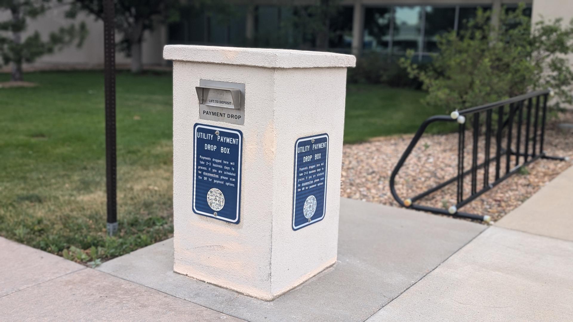
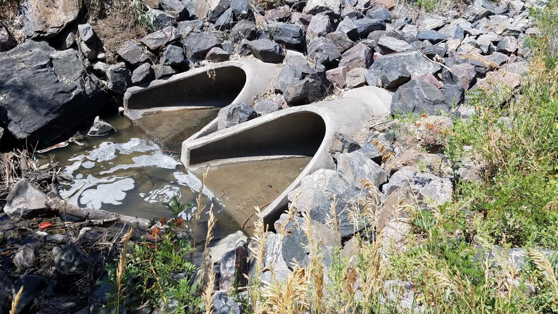
Report an illicit discharge
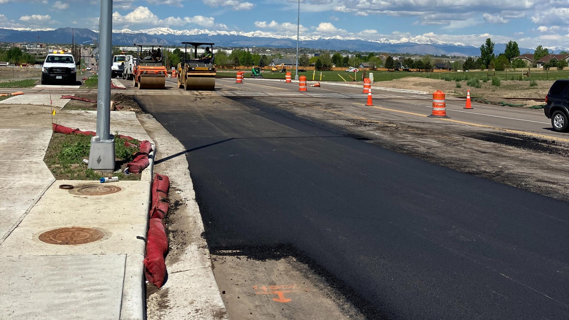
Contractor Resources
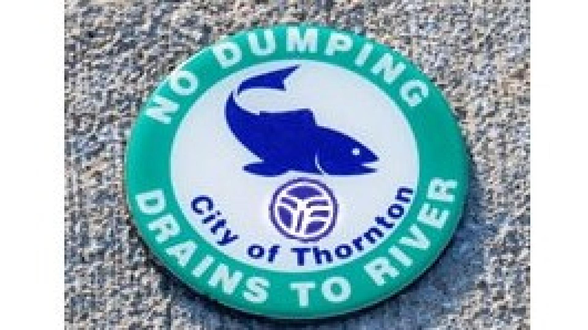
Volunteer Opportunities
Stormwater Maintenance Operations
Recognizing Illicit Discharges
Illicit Discharges, or illegal dumping, are a significant cause of stormwater pollution. When trash, fertilizer, antifreeze, paint, pet and lawn waste, and other pollutants enter the stormwater system water quality diminishes.
Common signs of an illicit discharge at stormwater drains include unusual color or cloudiness of the water, oil sheen, algae, strong/pungent or musty odor, dead vegetation or inhibited growth, dead animals, floating debris, pipe corrosion, surface scum or foam, stains on channel bottom or sides.
City Code Sec. 18-658
(a)
It shall be unlawful for any person to discharge or cause to be discharged into the storm drainage system of the city any pollutant or any other material which is not composed entirely of storm water, except for items listed in subsection (c) below.
(b)
It shall be a complete defense to the application of this division that such discharge was made pursuant to the Colorado Water Quality Control Act and the Colorado Discharge Permit Regulations or resulted from emergency firefighting activities.
(c)
Unless the city identifies any of the following categories of non-storm water discharges or any of the discharges addressed by the Low Risk Policy, WQP-27 issued or as revised by the Colorado Water Quality Control Division, as significant contributors of pollution to the city's municipal separate storm sewer system, these categories do not need to be addressed:
- Landscape irrigation.
- Lawn watering.
- Diverted stream flows.
- Irrigation return flows.
- Rising groundwater.
- Uncontaminated groundwater infiltration.
- Uncontaminated pumped groundwater.
- Flows from riparian habitats and wetlands.
- Water line flushing.
- Discharges from potable water sources.
- Foundation drains.
- Air conditioning condensation.
- Water from crawl space pumps.
- Footing drains.
- Individual residential car washing.
- Dechlorinated swimming pool discharges.
- Water incidental to street sweeping.
Stormwater Capital Improvement Projects (CIP)
The CIP program provides for cost-effective design and construction of capital projects. The city's CIP includes projects that provide an enhancement to the quality of life for citizens or result in the reduction of the cost of ongoing maintenance. The City maintains a five-year plan, which is updated annually.
Projects include improvements to transportation, city facilities, trails, water, storm sewer, and sanitary sewer systems. This site contains major CIP projects that are of interest to the public. The city also performs ongoing maintenance projects not included on this site. Please click the link above for more information on current and future CIP projects.
| Project | Status | Stormwater Fee Contribution |
Local Drainage Improvements
| Construction Phase | $25,000/year |
| Storm Culvert Lining | Construction Phase | 2026: $150,000 |
| 110th and Elm Drive - Storm Extension | Future Project | 2027: $150,000 2028: $400,000 |
| Grange Hall Creek South Tributary Culvert and Detention Improvements at Washington Street | Design Phase | 2027: $1,000,000 |
| Grange Hall Creek NE Tributary Outfall at Carpenter Park | Construction Phase | 2026: $500,000 |
| Basin 4100 Outfall Improvements | Future Project | 2028: $300,000 2029: $1,000,000 2030: $1,000,000 |
| Niver Creek Tributary N Improvements at Huron Street | Future Project | 2028: $426,000 2029: $341,000 2030: $2,568,000 |
| Hoyt Drive Storm Outfall Improvements | Future Project | 2028: $100,000 2029: $250,000 |
| Storm Manhole Rehabilitation | Future Project | 2028: $50,000 2029: $50,000 2030: $50,000 |