
Parks & Open Space
The Projects and Planning Division is primarily responsible for the planning and design of the city's parks and open space capital projects, implementation of the Thornton Parks and Open Space Master Plan, liaison with the Parks and Open Space Advisory Commission, and administration of grant program as it relates to projects.
Each year, the city receives requests from residents for improvements throughout the city. During the annual budget cycle, an ongoing list is updated and reviewed for consideration. All requests received during the current year, and requests from past years that have not been funded, compete for annual funding along with other city needs for roads, water/sewer, traffic, parks maintenance and repairs, etc. For information on parks and recreation related capital projects in progress, please click on the Capital Improvements Project link on the right side of the page.
The Division also works with the Parks and Open Space Advisory Commission (POSAC) in implementing and updating the city's Parks and Open Space Master Plan, updating the Trails User Map and making recommendations to city council on acquisitions and development with parks and open space tax funds.
The Thornton Parks and Open Space Master Plan (Plan) establishes goals, objectives, recommendations and implementation strategies for the planning and development of new parks, recreation facilities/programs, trails, and open space in the city of Thornton. It serves as a detailed supplement to the Thornton Comprehensive Plan, and as such, it responds to the goals and policies related to parks, recreation, trail and open space stated in that plan. The Plan also serves as a guide for continued improvements and expansion resulting in a high quality, citywide system of parks, recreation facilities/programs, trails and open space that will meet the needs of Thornton citizens now and in the future.
The Parks Open Space Trails User Map serves as an aid to enjoy the city’s trail system, showing parks, open space and trail corridors. The vision of the Parks and Open Space Master Plan is shared on the other side of the map along with a matrix of recreational amenities in the existing parks and open spaces.
The phrase "string of pearls" has been adopted to convey a powerful visual image that readily communicates Thornton's vision for the parks, recreation, trails and open space system. Rather than the patchwork quilt of green spaces that characterizes many communities' systems, the city of Thornton parks, recreation facilities, open spaces and other civic and community places such as schools, are to be linked by a system of off-street trails and pedestrian and bicycle friendly streets.
The "pearls" within the system include opportunities for both active and passive forms of recreation and protect and utilize the city's environmental and historical assets as part of the overall system. Open space "pearls" include existing wildlife habitat, vegetation, the South Platte River, Niver Creek and Big Dry Creek and their tributaries, and existing irrigation ditches and reservoirs that were built when the Thornton area was a farming community. Below are just a few of Thornton's open space "pearls".

Badding Open Space
In December, 2010, the city was able to add almost 11 acres of open space at the corner of Thornton Parkway and the I-25 southbound exit ramp, with help from an Adams County Open Space grant award of $914,338. The property visually expands Thornton's existing 17 acre Badding Open Space to the north, provides an additional visual buffer along Thornton Parkway and I-25 and protects environmental resources and wildlife habitat.
Badding Open Space Aerial [PDF/281KB]

Big Dry Creek Open Space
Just as the South Platte River is the natural resource defining Thornton's eastern boundary and as Niver Creek defines Thornton's southwest open space area, so Big Dry Creek is the natural feature that shapes Thornton's central northwest topography. Within Thornton, Big Dry Creek travels approximately 6 miles, from the city's western boundary at I-25 and approximately 132nd Avenue to northeast of 168th Avenue, east of Colorado Boulevard. Big Dry Creek is approximately 110 miles long, its watershed beginning on the Front Range at the mouth of Coal Creek Canyon and flowing to Standley Lake in Jefferson County. From Standley Lake, Big Dry Creek flows in a northeasterly direction through the cities of Westminster and Thornton then unincorporated Adams and Weld Counties to where it joins the South Platte River near Fort Lupton.
Within the city's overall planning effort, the Big Dry Creek corridor provides outstanding opportunities for preservation and enhancement as a passive recreation, wildlife habitat and open space area. As identified in Thornton's Parks and Open Space Master Plan, Big Dry Creek and its floodplain are an important natural resource for east-west wildlife movement and regional trail connectivity through this ecologically diverse drainage corridor.
In 1997 and again in 2013, Thornton voters passed a ballot initiative allowing for a .25% sales and use tax increase for parks and open space acquisition and development. Using these funds, and along with Adams County, over 300 acres of open land along the corridor in Thornton have been preserved, mostly as natural stream bordered by undeveloped floodplain. The city owns one park facility, Thorncreek Golf Course of which approximately 44 acres are in the corridor, plus six open space parcels along Big Dry Creek totaling over 250 acres and Adams County owns two open space parcels totaling over 49 acres. The development intent for the corridor is to remain natural and be used primarily as open space and wildlife habitat with passive recreation.
Click on the link below to see a map of recent Big Dry Creek open space additions.
Featured Capital Improvement Projects (CIP)
Margaret Carpenter Park Playground and Splash Pad Renovation
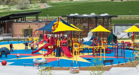
Current concept design and August 15 accessibility listening session:
Design is underway for the renovation of the Margaret Carpenter Park playground and splash pad, with construction anticipated in 2027-28.
Since the project began in February, local residents and families have provided extensive feedback to help shape the redesign of this beloved community play space.
City staff gathered input from fifth-grade students at Adams 12 STEM Lab; families attending weekly pop-up events in the park throughout March; and hundreds of community members at the Eggcessible Eggstravaganza, ward community meetings, the Arbor Day tree sale and Thorntonfest. More than 500 people also responded to an online survey.
Staff used this feedback to develop and evaluate three early design concepts.
Based on community input, the design team developed the current concept shown below. The existing playground is largely flat. The proposed design would introduce hills, valleys and terraced play areas to create a more engaging experience for people of all abilities.
Accessible routes would wind through the changing elevations, allowing visitors to reach play areas in different ways and making movement through the playground part of the play experience.
Proposed features include:
- Elevated nature-observation play towers connected by a bridge
- Accessible routes through hills, valleys and terraced play areas
- Play areas designed for different ages and abilities
- Swings, spinners, climbing features and a dual zip line
- Hill play, slides and a variety of accessible play surfaces
- Musical and sensory play
- Shaded gathering and seating areas
- Quiet spaces and places of refuge
- A nature-inspired splash pad with interactive sprays, water channels and stone features
Accessibility Listening Session
On August 15, the city held a disability-focused listening session to gather more detailed feedback on accessibility and inclusion in the current design.
Participants reviewed the concept from the perspective of arriving at the park, moving between different elevations and activity areas, participating in play and water experiences, resting and gathering, supporting family members and preparing to leave.
Feedback from the listening session will help the design team identify additional opportunities to improve access, comfort, play value and the overall experience for people with disabilities and their families.
The plans shown here represent the current stage of design and will continue to be refined as additional community feedback and technical analysis are incorporated.
Current Concept Plans
The following graphics illustrate the current concept, including circulation through the site, proposed playground and splash pad experiences, and the relationship between activities located at different elevations.
View Splash Pad Concept Designs [PDF/31.2MB]
Conceptual design note: These plans are conceptual and subject to continued refinement. Additional project updates will be shared as the design progresses.
Take the Carpenter Playground and Splash Pad Redesign Survey

Eastlake Grain Elevator:
The Eastlake Farmers Co-Operative Grain Elevator, located at 126th Avenue and Claude Court, is the centerpiece of the future historical exhibit area to be located just north of the RTD North Metro FasTracks station. The elevator was built in 1920 and on May 17, 2010 was named to the National Register of Historic Places and Colorado State Register of Historic Properties, in recognition of its contribution to the heritage of the State of Colorado. As part of its historical preservation, the elevator underwent a structural assessment. Repairs were made to its metal clad exterior and it was painted "grain elevator" white.

Railroad Track Donated & Installed by the Union Pacific Railroad:
Other historic components include railroad track donated and installed by the Union Pacific Railroad, with Thornton's Streets Division help. Aaron and Damita Holland, who met when they both worked in Thornton, are the McDonald's restaurant owners in Boulder that donated its wonderful caboose to the city. The caboose was built in 1920 as a freight car for the Chicago, Rock Island and Pacific Railroad and has a steel frame on its outside, making it stronger than a typical 1920-era caboose. Because of increased railroad shipping during World War II, the freight car was converted to a caboose in 1942 to provide living space for five railroad workers. It was assigned to Stapleton Airport on Quebec Street and was in use until 1977. In 1978, the caboose was restored and moved to Boulder's 28th Street McDonalds restaurant to serve as a children's party venue. Moving the caboose from Boulder to Eastlake was quite a process! The caboose is now located at the south side of the elevator.

Wonderful Caboose Rehabilitation:
The historic ‘Wonderful Caboose’ at approximately 126th Avenue and Claude Court has undergone a full exterior rehabilitation that included restoration of the original exterior planking, extensive painting, replacement of windows, doors and the roof, and installation of metal bollard enclosure.
Project Plans & Information
- Lambertson Lakes Master Plan [PDF/118.9MB]
- Heritage Trail Concept Plan [PDF/13.2MB]
- Big Dry Creek Recreation & Floodplain Restoration Master Plan - Executive Summary [PDF/556KB]
- Big Dry Creek Recreation & Floodplain Restoration Master Plan - Final Plan [PDF/38.4MB]
- Big Dry Creek Recreation & Floodplain Restoration Master Plan - Appendices [PDF/26.6MB]